
Wausau ZIP Labels at a Glance
Official USPS label material identifies three Wausau ZIP labels: 54401, 54402, and 54403. Wisconsin administrative sources and Census ZCTA data commonly associate the standard geographic area with 54401 and 54403. The evidence describes delivery labels, not a map of city limits. Each exact house still needs an address-level USPS check, followed by a parcel municipality check when city status matters.
| ZIP Code | Areas Covered | Post Office | Notes |
|---|---|---|---|
| 54401 | Wausau delivery area; may include nearby mailing areas | Wausau label route | Verify street and municipality by address |
| 54402 | Secondary, PO-box-oriented Wausau label | Wausau label route | Do not infer a residential street area |
| 54403 | Wausau delivery area; may include nearby mailing areas | Wausau label route | Street splits and overlap require lookup |
The inspected USPS static material does not provide a parcel-level boundary or a complete street-by-street station assignment. That gap is important. The Wausau ZIP code directory should never turn a broad label list into a claim about who lives on a street or which government has jurisdiction.
Verify a Wausau ZIP by Address
The USPS ZIP Code Lookup offers address-level, city-and-state, and ZIP-based paths. Use the address route for a house because a city-name search cannot resolve a road that crosses a ZIP boundary, a nearby municipality with a Wausau mailing label, or a code used chiefly for post-office boxes.
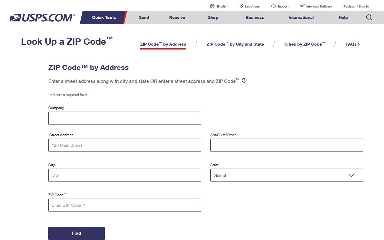
The official lookup is the starting point for a postal check. Save the query date and redact personal details if the result will be shared. Report the answer as a mailing field, not proof of city limits, parcel ownership, a voting district, or neighborhood membership.
Wausau ZIP Search Fields
Different official tools answer different questions. USPS assigns the mailing ZIP code. Marathon County property listing connects a parcel to an owner, property address, location, and 14-digit PIN. MyVote uses an address to return district and election information. No stable ZIP-only filter was found in the inspected county property or city assessment pages.
| Official interface | Inputs | Useful result | Limit |
|---|---|---|---|
| USPS address lookup | Street, city, state | Address-level postal ZIP | Does not establish city limits |
| USPS city/state lookup | City and state | Labels tied to a place name | Too broad for one parcel |
| County property listing | Owner, address, location, or PIN | Parcel and municipality evidence | No ZIP-only field documented |
| MyVote address search | Street, optional unit, city, ZIP | District and election information | Best used for one's own record |
A ZIP identifies mail routing. A PIN identifies a parcel in the county system. Neither field, on its own, identifies every resident at an address.
Narrow Wausau Residents by ZIP
A ZIP code directory works best as a narrowing tool. Since local parcel and assessment sources did not expose a ZIP-wide filter in the inspected pages, confirm the postal label first and then move to a street, parcel, or properly scoped public-data request. This avoids inventing a ZIP boundary from scattered results.
- Enter the complete address in USPS lookup. Record the mailing city and ZIP code with the date checked.
- Search Marathon County property listing by address or location. Note the parcel municipality and 14-digit PIN separately.
- Open county GIS when map context is needed. Do not treat nearby parcels as one household.
- For personal election questions, use MyVote's street, optional unit, city, and ZIP fields. A match is not a public resident list.
- If a formal voter-data request is justified, define geography and fields through WEC or Badger Voters and follow current rules.
Once the code is known, the Wausau street directory explains how to shift to address-keyed parcel and deed evidence. That is more exact than inferring a household from a ZIP-wide list.
What Wausau 54402 Establishes
54402 is the key oddity in the Wausau ZIP code directory. Inspected official material supports describing it as a secondary, PO-box-oriented label. It does not support drawing a residential area for that code or assigning streets to a current station. An address-level result is required before attaching 54402 to a particular mailing record.
Box service separates a mailing point from the physical parcel. If a record shows only a post-office box, consult a lawful address source or ask the custodian for the specific record needed. Do not fill the gap with assumptions.
Wausau Mailing and City Labels
Three geographic fields can disagree: USPS mailing city, postal ZIP, and incorporated municipality. A mailing address labeled Wausau can lie outside Wausau's city limits. A city parcel can also carry a ZIP used by nearby areas. Record each field in its own column, along with its date and official source.
| Field | Controlling source |
|---|---|
| Mailing city and ZIP | Current USPS address-level result |
| Parcel municipality | Marathon County property listing or GIS parcel record |
| County | Parcel or official jurisdiction record |
| Verification date | Date the dynamic portal was checked |
This format preserves a real disagreement instead of forcing one label to serve every task. It also makes later corrections easier when postal routes or portal data change.
Wausau Neighborhoods Are Not ZIPs
Wausau's N2N neighborhood boundaries follow local features such as the Wisconsin River, Lake Wausau, Grand Avenue, Forest Street, railroad tracks, creeks, and city limits. Longfellow, Northwest, Riverview, Southeast Side, and Southwest Thomas Street all use such lines in published descriptions. These civic boundaries are not postal codes.
The county addressing system uses a southwest grid origin and an even-and-odd directional convention. That can help test whether a printed number is plausible, but it does not turn a ZIP into a neighborhood. Use N2N maps for civic context, USPS for mail, and the parcel system for municipal geography.
Wausau ZIP and Voter Geography
Wisconsin MyVote's address form asks for street address, an optional unit, city, and ZIP. It returns district, polling, and election information for the address. Use the full street name and type, add directionals where needed, and keep the mailing city consistent with the postal result. Formatting can affect whether the address matches.
MyVote is not a way to publish a list of people in one ZIP code. The name form is intended for a voter to find a record with first name, last name, and date of birth. Formal public voter data follows Wisconsin Elections Commission rules and can be scoped by state, county, municipality, or ward. The researched sources do not document a ready-made registered-voter count by Wausau ZIP.
Wisconsin also protects confidential electors. Safe at Home participants use a legal substitute address, and their actual address must not be disclosed. A missing or substitute address is a hard privacy boundary, not a gap to solve through another directory.
Wausau ZIPs and Census ZCTAs
A Census ZIP Code Tabulation Area, often shortened to ZCTA, is a statistical shape based on ZIP-related address patterns. It is not the USPS delivery system itself. Census data may associate Wausau's standard geographic area with 54401 and 54403, while USPS label material also includes 54402. Both can be accurate because they answer different questions.
Use ZCTA data for published population statistics only when the dataset and year are named. Use USPS for a present mailing address. Do not borrow a ZCTA outline as though it were a precise postal boundary, and do not use its population as a count of city residents. A ZCTA can extend beyond an incorporated place or omit box-only service that has no normal residential shape.
Record a Wausau ZIP Result
A good ZIP note is short and reproducible. It keeps the address used, postal response, parcel municipality, and verification date apart. If the address has been redacted for privacy, retain enough non-personal source detail to explain the method without exposing a resident.
- Copy the address as supplied, including unit and directional text.
- Save the USPS city and ZIP response with the query date.
- Check the county parcel's municipality and PIN when jurisdiction matters.
- Describe any mismatch plainly instead of deciding that one system is wrong.
Dynamic data deserves a fresh check. The research inspection date was September 3, 2026, and USPS assignments, voter interfaces, assessment pages, and parcel portals may change after that date.
Wausau ZIPs Versus City Limits
A ZIP code boundary serves postal operations, while a city limit controls municipal jurisdiction. They can overlap without matching. When an address has a Wausau mailing label but the parcel system names another municipality, publish both facts with sources and dates. The difference is often normal postal geography, not a bad record.
- ZIP and ZIP+4
- A ZIP is the five-digit delivery area. ZIP+4 adds a smaller delivery segment and should come from a current postal result.
- PO-box ZIP
- A code or label used for post-office box mail rather than a mapped residential street area.
- Unique ZIP
- A code assigned to one high-volume recipient. No unique Wausau code was established in the inspected sources.
- Carrier route
- A mail-delivery path inside a ZIP. It is an operational route, not a city or neighborhood boundary.
USPS assignments and portal behavior can change. Verify the address again before relying on the result, especially for family, property, or civic research.