
Sources for Wausau Neighbors
The strongest block search begins with geography. Marathon County GIS shows parcel shapes, address points, parcel IDs, owner-name layers, and rights-of-way. The county property listing then supplies the tax-listing owner, PIN, site address, mailing context, and an abbreviated legal description. Those two sources describe land and the name used for tax listing. They do not disclose every person who occupies a Wausau home.
| Source | What It Shows About a Block | Access |
|---|---|---|
| Marathon GIS parcel map | Adjacent shapes, parcel IDs, address points and rights-of-way | Live map; not a legal survey |
| County property listing | Tax-listing owner, PIN, site and mailing distinction | Search by PIN, owner, address or location |
| LandShark | Deed, easement and plat parties with dates | Free index; image or copy route may cost |
| MyVote and Badger Voters | District information or lawful geography-based voter data | Not a live public block roster |
| Wausau N2N | Civic boundaries, meetings, maps and contacts | No complete member list |
| MCPL and MCHS directories | Dated historical occupants by address or street | Repository or licensed access |
A parcel owner may have a different mailing address. The owner may also be a trust, estate, company, or family member. A deed party could be a grantor, grantee, mortgage party, or easement party rather than a resident. Historical directories can name occupants in one publication year, but they are not evidence of the present block. The source date and record role keep the neighbor search honest.
See Wausau Parcels Together
The Marathon County viewer supports a visual adjacent-parcel method. Search or locate the subject PIN or address, turn on parcel and address-point layers, then pan and click parcels that share a boundary or face the same street segment. The public REST service confirms parcel lines, address points, parcel IDs, owner-name layers, and rights-of-way.
No stable documentation was found for a dedicated radius or neighbors button. Do not estimate a buffer from a screenshot. Record each clicked parcel ID and describe its map relation, such as shared boundary, across the street, or same segment. County cadastral data is reported as updated monthly, while ownership changes may take months to appear.
The Marathon County parcel viewer supplies the visual starting point.
The map helps identify which parcel cards to inspect next, but its lines are not a survey and do not prove who occupies a home.
Note: Check boundary, easement, and legal-description questions against a survey, plat, certified map, or recorded instrument.
Record a Wausau Block
For each nearby parcel, keep separate columns for the parcel ID, map relation, tax-listing owner, source date, and any documented relationship. That last field usually remains blank. Adjacency means spatial proximity only. It never establishes kinship, friendship, shared business, or civic membership.
| Field | How to record it |
|---|---|
| Parcel | Use the 14-digit PIN without punctuation when the search requires it |
| Map relation | Shared line, across street, or same block face |
| Tax-listing name | Copy the role as displayed; do not call it occupancy |
| Record date | Note the cycle or date inspected |
| Relationship evidence | Enter only a documented deed, easement, plat, or other record link |
If the parcel listing supplies a mailing address different from the site address, retain both labels. The displayed ownership and legal description are abbreviated tax-listing information. When a legal connection between parcels matters, inspect the deed, easement, certified survey, or plat.
The county's parcel information service documents the map layers behind this workflow.
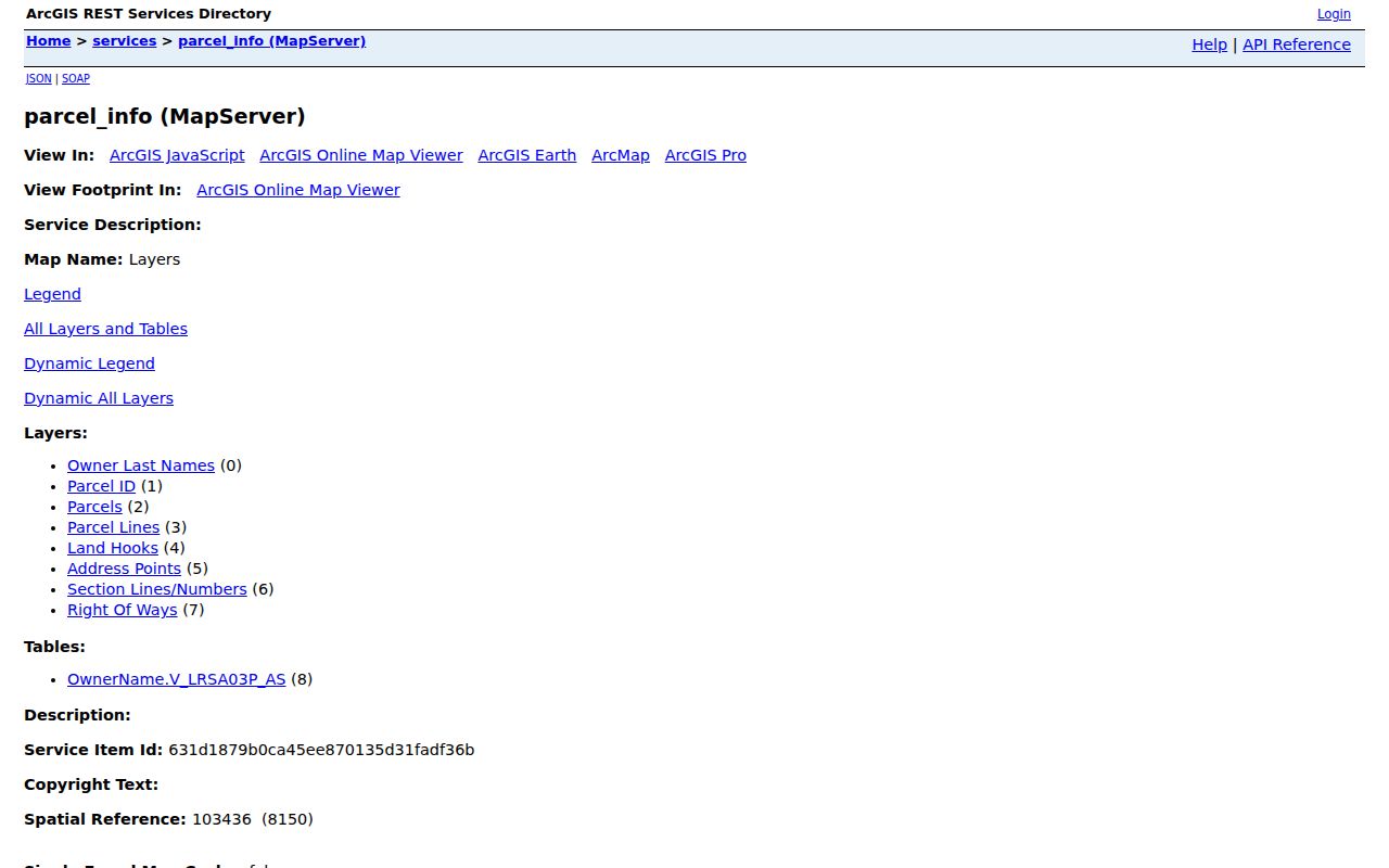
The layer inventory confirms which map facts are available and reinforces why a social relationship should never be inferred from adjacency.
Map Wausau Neighbors by Parcel
Move from map to record in a fixed sequence. This keeps the Wausau neighbors search focused on the immediate block and prevents a tax-listing name from being mistaken for a household list.
- Locate the subject address or PIN in the Marathon County GIS viewer.
- Turn on parcel and address-point layers, then click parcels that touch or face the subject.
- Search each returned PIN in the county property listing and record the site and mailing fields separately.
- Check a deed, easement, plat, or permit only when it answers a specific property question.
- For a longer road-wide chain, use the Wausau street directory.
The flow is address → parcel map → adjacent PINs → property cards → dated instrument when needed. Stop after the immediate block unless the research question calls for a wider area. That boundary separates a neighbor lookup from a whole-street project.
Wausau Neighborhood Connections
Wausau's N2N program provides the civic layer that parcel data cannot. The city lists Athletic Park, East Towne, Forest Park, Grant, Longfellow, Northwest, Riverview, Southeast Side, Southwest Jones, Southwest Thomas Street, Werle Park, and Westies as named areas, while stating that 11 associations are operating. Boundaries, meeting places, map links, public contacts, and current meeting status support community outreach. The page does not publish a full membership directory.
Grant and Longfellow
Grant lists a first-Tuesday meeting pattern. Longfellow lists first-Monday meetings, though status should be checked on N2N.
Riverview and Werle Park
Riverview lists fourth-Thursday meetings. Werle Park uses a second-Monday schedule.
South Side Groups
Southwest Jones lists fourth-Monday meetings, while Southeast Side publishes a quarterly schedule.
A meeting schedule can change, and some groups may not currently meet. Use the city page to confirm the latest notice. Attendance or a parcel within a mapped boundary does not prove association membership.
One Wausau quirk deserves care: N2N reports 11 operating associations while displaying a broader set of named neighborhood areas and map links. Treat the operating count and the map labels as separate facts.
Wausau Voter Data Boundaries
MyVote's address search returns district, polling, and election information for an address. It is not a convenient public roster of Wausau neighbors. The name route asks for first name, last name, and date of birth so a person can select their own record. Wisconsin Elections Commission data may be requested by geography through Badger Voters, but statutory fields, fees, and confidentiality rules still apply.
A public voter dataset can include names, addresses, districts, and elections voted as authorized. It does not reveal how anyone voted, and Wisconsin has no party registration. Date-of-birth details, license and Social Security verification fields, protected addresses, and confidential-elector records must not become a block list. For history beyond ten years, WEC directs researchers to a formal request rather than a live local archive.
Use election data to help a resident check their own status or to study lawful geographic patterns. It should not be used to publish names at every nearby house.
Compare Wausau Neighbor Tools
Official records and commercial neighbor tools answer different questions. County and state sources state who keeps the data, when it was recorded, and what the field means. Commercial compilations can blend filings, licensed data, and inferred links without showing a clear date or record role.
| Source type | Useful for | Main caution |
|---|---|---|
| County GIS and property listing | Parcel location, PIN and tax-listing owner | Not proof of occupancy or a legal survey |
| Recorded instruments | Dated deed, easement and plat roles | A party role is not current residence |
| N2N civic sources | Boundaries, meetings and public contacts | No complete member roster |
| Commercial compilations | Possible leads requiring confirmation | Stale addresses and inferred household links |
Use a primary custodian to verify any important fact. Removing a listing from a commercial service does not correct the originating parcel, court, voter, or deed record.
Past Wausau Neighbors
MCPL, MCHS, and Wisconsin Historical Society collections can place former occupants on a Wausau block. City and telephone directories provide dated name-and-address entries. Census schedules add household and street context through the public 1950 release, while newspapers may explain a move, death, or civic event. Each item is historical evidence for its year.
Reverse or criss-cross directories, when a repository volume supports address-first use, can scan a street segment more efficiently than a name index. Record the title, edition, page, address as printed, and repository. Old directionals and street forms should be preserved, then tested against modern parcel and address tools.
Community resources such as yearbooks, ethnic-group materials, fraternal papers, or veterans' post records may offer public historical context. Membership files can be private or restricted, so cite only an accessible published item or a repository description.
Wausau Neighbor Lookup Limits
Private household members, non-owner occupants, utility customers, delivery records, protected voters, and Safe at Home actual addresses stay outside a Wausau neighbor lookup. Safe at Home participants use a legal substitute address. If an actual protected location appears in another source, stop publication and contact the custodian or Wisconsin DOJ.
Lawful use. Research Wausau neighbors only for lawful personal, civic, family-history, or safety purposes. Never watch, stalk, harass, intimidate, or harm another person.
Records can lag or contain errors. Keep the source date, identify whether the name is an owner or occupant, and ask the originating agency to review a mistake. A blank result does not prove that no one lives at the address, and a shared parcel line does not prove any personal relationship.